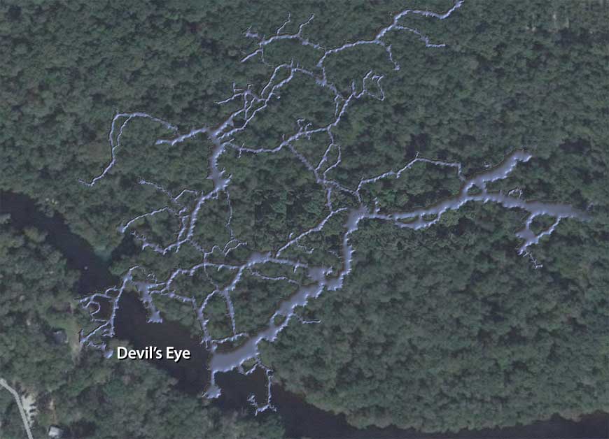
 While filming this week’s Cave Country episode of ScubaNation, producer “Bitchin’ Mitch” Horne asked me whether it would be possible to produce an effect in which you start with a Google Earth zoom-in on a particular piece of real estate, just above an underwater cave, that have that dissolve to reveal the cave underneath.
I told him that I thought it was, and created a 3D rendering of the first third of the Devil’s Eye system for him to use in the show. Well, I got impatient to see what Mitch would come up with, so I created my own version of what we talked about and posted it on Facebook. If you’ve not yet seen it, here it is:
Okay, there are a few things you need to understand when looking at this:
- There are limits to the accuracy of our cave maps, chiefly due to the fact we rely on knotted line for distance measurements and small, mechanical compasses for direction. If you have ever compared Steve Berman’s map of the system to Jeff Hancock’s, you know that they do not line up precisely with one another. In fact, in many instances, they are not even close.
- I chose to show only the first third of the cave system, as showing the entire system in a video would make the passages vanishingly small. The first third of the cave, however, gets over 90 percent of the traffic, and is what divers are most familiar with.
- I matched the cave map to the Google Earth aerial image by aligning Devil’s Eye and July Spring with their approximate locations on the Google map. As the distance between the two is just a tiny fraction of the length of the entire system, this could have easily led to an error in scale of up to ten percent or more.

Understand that I have spent more time in this particular cave system than I have in any other dive site on the planet — literally over 1,000 hours. Yet seeing it like this caused me to realize things that I never noticed before. For example:
- Surprisingly little of the cave lies under the river. As soon as you hit the Lips, you will spend most of the balance of your dive underneath Columbia County. What many people don’t realize is that, where Ginnie Spring’s water comes from Gilchrist County, the water coming out of Devil’s Eye and Ear is all from Columbia County. There is a noticeable difference in clarity and water quality between the two.
- Because you swim across the river when traversing the Gallery, then make a hard right turn at the Lips, it is easy to assume you are following the north shore of the river as you go further into the cave. While the cave system as a whole does parallel the river, the first third is actually arrayed more perpendicular to the river than anything else.
- If you look at the size of the main line tunnel upstream of the Maple Leaf, coupled with the immense size of the Big Room, it’s apparent that a lot of water had to move through these at one time to create passages so big. And yet, where the Big Room joins the Bone Room, this large passageway abruptly ends. What happened?
I’ve seen this relationship on the cave maps for years, yet it only struck home when I saw it rendered in 3D. The next time I’m in the Bone Room and Big Room, I’m going to look for evidence suggesting that there might have once been a cave exit here.
Another possibility is that all of this water used to pass into large chambers that lie below the part of the cave we normally see. Think about this the next time you swim up Hill 400 or back through the Wonder Tunnel. There are deep indentations in the floor, and silt is clearly being sucked down into something.
The opening of the New Section showed us that there are deeper portions of the cave upstream. There could easily be more right below us, and we don’t even realize it. In any event, these are all possibilities i never would have realized had I not seen the relationship of the cave to the ground above it.
Applying This Technique Elsewhere
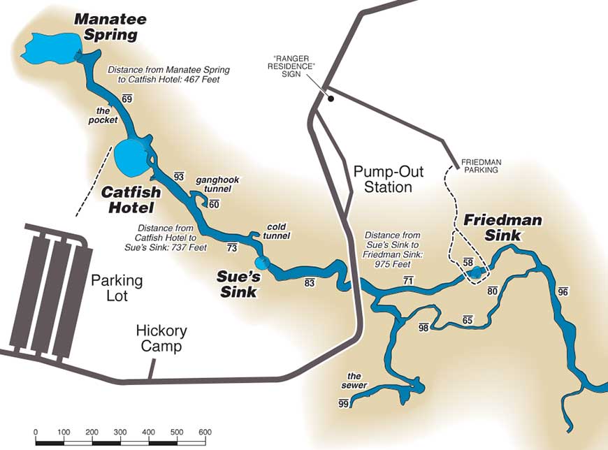
In 1998, I got something of a burr up my butt and decided that I needed to create an overlay to Sheck Exley’s Manatee Springs map that showed the relationship of the cave to the roads, parking lots and campgrounds above it. The catch was, the only way I could measure the long distances involved was to pace them off (not exactly the most accurate method). Compared to this, knotted line is incredibly precise.
Nevertheless, what I plotted seemed to match up fairly well with Sheck’s map. Here is what I came up with:

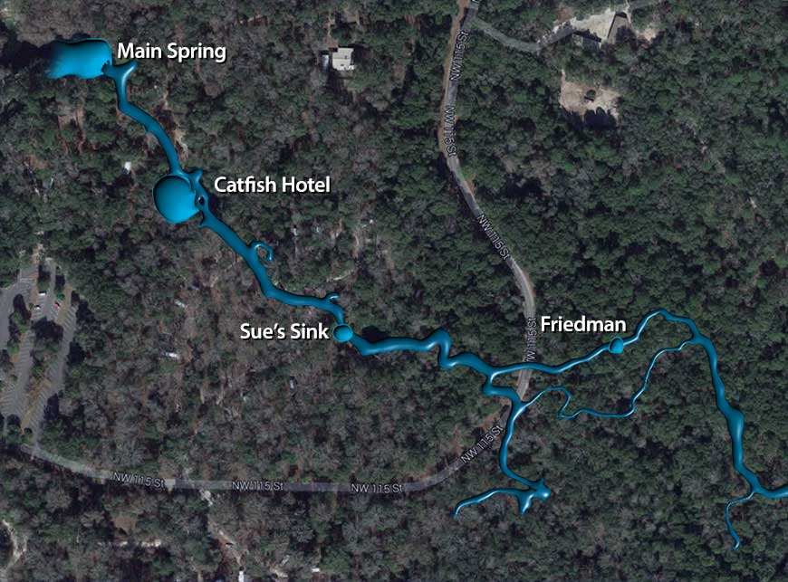
Now we have Google Earth and Google Maps — tools that just plain did not exist back in 1998. Having completed the Devil’s Eye rendering for ScubaNation, I wanted to apply the same method to my Manatee Springs map, to see just how accurate it was.

All things considered the two aren’t that far off. One thing I noticed is that there are several darker areas among the trees that appear to correspond to where the cave lies. Coincidence? Not likely.
I want to apply this technique to some of our other popular cave diving sites and see just what I may discover than I haven’t noticed before.
